


Imagine a world where gathering detailed terrain data is as swift and simple as launching a drone. Drone mapping is doing just that—transforming the way we analyze landscapes with precision and speed. By harnessing cutting-edge technology, professionals can now generate 3D models and accurate maps faster than ever before, unveiling insights that were once hidden beneath the surface. Dive in to discover how this revolution is reshaping industries and decision-making processes alike.
The impact of drone mapping on terrain analysis
Drone mapping is significantly improving the precision and efficiency of terrain analysis. By using aerial data, professionals can make better-informed decisions quickly, leading to enhanced project outcomes. Various sectors, including construction, agriculture, and environmental management, are now leveraging this innovative technology for superior insights.
Enhanced accuracy in terrain data
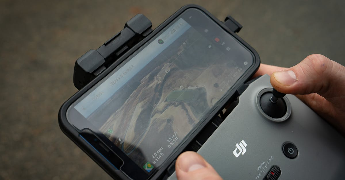
One of the primary advantages of drone mapping is its ability to provide high-resolution images that facilitate accurate terrain assessments. Traditional surveying techniques often lack the level of detail that drones can capture.
Drones equipped with advanced GPS technology and high-definition cameras deliver images that not only improve precision but also expedite the data gathering process. As a result, terrain models are more reliable and reflect real-time conditions without the delays typically associated with manual surveying methods.
Furthermore, the combination of aerial imagery and sophisticated software enables the creation of 3D models and orthomosaics, enhancing the understanding of the land’s characteristics. These models are vital for identifying slopes, vegetation cover, and other features of interest.
Cost-effective solutions for various industries
Drone mapping significantly reduces the costs involved in terrain analysis. Traditional methods often required extensive manpower and expensive equipment. By contrast, drones offer a more affordable alternative. A fewer number of personnel can efficiently conduct larger surveys in a shorter time frame.
This technological shift allows companies across multiple sectors to allocate funds effectively. For instance, organizations can invest in high-quality drone technology without the burden of hiring large teams for fieldwork.
The potential for clients to save money while receiving superior results is a compelling reason to adopt drone mapping techniques.
Applications in industries
Drone mapping is not limited to one field; it has a spectrum of applications that bolster its significance in various industries. Some of the most notable applications include:
-
Agriculture: Farmers utilize drones to analyze crop health, assess growth patterns, and implement precision farming techniques.
-
Construction: Construction companies employ drones to monitor project progress, ensuring that operations adhere to timelines and budgets.
-
Environmental Monitoring: Drones help ecological groups track changes in land use, monitor endangered species, and evaluate habitat health.
-
Mining: In the mining sector, drones facilitate precise volume calculations and site assessments, maximizing efficiency while minimizing risks.
A closer look: features of drone mapping
To fully appreciate the impact of drone mapping on terrain analysis, we must look at some of the defining features of this technology. The following table highlights key characteristics:
|
Feature |
Benefits |
|---|---|
|
High-resolution cameras |
Captures detailed images for precise analysis. |
|
Real-time processing |
Enables immediate access to survey data. |
|
Advanced GPS technology |
Provides accurate geolocation data for improved modeling. |
|
3D modeling capabilities |
Helps visualize complex terrain structures. |
|
Cost efficiency |
Reduces traditional surveying expenses significantly. |
Challenges in drone mapping
While drone mapping offers revolutionary benefits, it is not without its challenges. Issues related to data quality, operational limitations, and regulatory frameworks can hinder successful implementation. Collecting reliable data requires well-maintained equipment and properly trained personnel.
Additionally, staying compliant with local laws governing airspace and privacy is crucial. As regulations continue to evolve, drone operators must actively adapt to ensure smooth operations.
By navigating these obstacles effectively, industries can fully harness the potential of drone mapping for terrain analysis.
 Drone mapping has fundamentally transformed terrain analysis by delivering precise, cost-effective, and efficient solutions across various sectors. The improved accuracy and faster data capture equip professionals with invaluable insights for their projects. As technology progresses, embracing these advances becomes essential for staying ahead in a competitive landscape.
Explore drone mapping for terrain analysis. Consult a specialist for expert support.